

Before Fred Mattera headed 160 miles offshore, there was one more thing he wanted to see.
The weather forecast could look good. His boat could be provisioned. The crew could be ready, and another captain could agree conditions looked favorable.
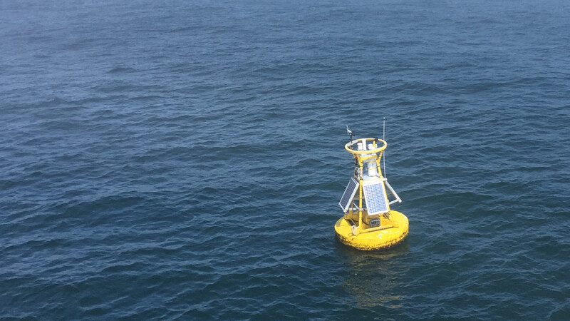
Mattera still checked the buoy.
After more than 40 years commercial fishing out of Point Judith, R.I., including offshore trips to some of the most distant fishing grounds on the East Coast, he knew the difference between what was forecast and what was actually happening at sea could be significant.
He also knew what that difference could cost.
During a panel at the 2026 Northeastern Regional Association of Coastal Ocean Observing Systems (NERACOOS) Annual Meeting, Mattera and other fishermen and mariners described ocean observations not as an abstract collection of scientific data, but as working information used to decide whether to leave the dock, where to fish, when to head home, and how much risk a crew is willing to take.
The discussion also revealed what fishermen want next: better access to information, more observations from the bottom of the ocean, easier comparisons between forecasts and actual conditions, and data that can help them fish more efficiently.
And once the conversation moved back ashore, another concern emerged.
Fishermen need the information to reach the fishing grounds.
They also need somewhere to land when they come home.
'There were no old, bold pilots'
David Goethel, a lifelong fisherman and research biologist, opened the panel with an old saying passed down to him by his father and older commercial fishermen.
"There were old pilots and bold pilots, but there were no old, bold pilots," he said. "And I use that because the same applies to commercial fishing."
Safety, he said, is something fishermen live with every day. And so is making their own weather forecast.
His boat carried a calibrated barometer and an anemometer to provide immediate conditions on site. Modern weather buoys add another layer, providing information including barometric pressure, wind speed and direction, sea state, water temperature, currents and salinity.
But fishermen do not necessarily look at those observations individually.
They combine them with what they know.
"Mariners can combine these observations along with their years of local knowledge to accurately assess the safety and feasibility of continuing to work," he told the audience.
The same observation can also have several uses.
A change in current may matter to a trawler towing gear. Water temperature can influence where fish are located. Sea conditions matter to the captain deciding whether to stay offshore, while the same information could later become critical to search-and-rescue personnel looking for someone in the water.
"Information provided for one purpose often aids numerous other people working on the water in different ways," he said.
That is particularly true of temperature.
An offshore wind can push warmer surface water away from shore and cause upwelling. Pelagic species can respond to the resulting temperature changes.
"Knowing how to use this information makes for a better, more effective fisher," he said.
'I'm glad we scratched today'
Hattie Train grew up in a commercial fishing family, studied marine science and later worked in the Portland harbormaster's office. Her experience also includes search-and-rescue training with the U.S. Coast Guard and work as a volunteer rescue swimmer.
Before the meeting, Train reached out to people across her waterfront network and asked whether they actually used ocean-observing data.
The responses were immediate.
"Checking that data before getting on the water is a no-brainer," one charter captain told her.
A tug operator said he used it "all the time." A commercial fisherman called the information "a vital cog in the working waterfront."
Train knew the answer before she asked.
"I know for a fact that my father and many of his friends who make a living as commercial fishermen use this information every day to decide when to leave, when to come home, and what they're going to encounter, and what areas they want to fish that day," she said.
She described storm days when her phone fills with screenshots of buoy observations accompanied by messages from fishermen.
"Oh, look at those numbers, I'm glad we scratched today," one might say. Or: "Oh, that would be wild on the back shore."
"This data isn't just data on the screen," Train said. "It's information that people trust and rely on to make decisions every day."
For her, the value of observations is not that they override what fishermen already know.
"I've always believed that nobody knows the ocean better than the people who work on it every day," Train said. "The data isn't there to replace experience and knowledge, but it's another tool we can use to make these decisions."
That relationship between observation and experience became one of the clearest themes of the meeting. Fishermen have always read the ocean. Buoys, sensors and forecasts simply give them more things to read.
When the forecast isn't enough
Mattera took that point 160 miles offshore.
Before one offshore lobster trip, he recalled, the forecast looked favorable. But he checked buoy 44011, located near the grounds where the boat was headed.
There was a reason.
Mattera recounted the story of the Fairway, a lobster boat that had been fishing offshore alongside several other vessels when conditions deteriorated.
The forecast had called for winds around 20 to 30 knots. Then conditions built. The boats eventually started steaming inshore.
The Fairway was caught in large following seas and overturned. One crewman survived in a life raft and was found by the Coast Guard three days later.
Mattera carried that story with him when making his own offshore decisions. On the trip he described to the NERACOOS audience, the forecast appeared favorable. The buoy told a different story.
"When I looked at those conditions, which gave me the wave heights, which gave me the wind, the velocity was 30 to 40," Mattera said. "The sea conditions were 12- to 15-foot seas."
Offshore, there may be no other boat nearby to call for a firsthand report.
"We relied on that weather buoy to give us those conditions," he said.
The decision to postpone a trip affects more than immediate safety. It can reduce crew fatigue and wear on the vessel and gear. It can prevent hours of steaming slowly into heavy weather while burning additional fuel.
"There's nothing worse than starting a trip with heavy seas and heavy conditions," Mattera said.
Finding the break
The same buoys that tell fishermen whether they want to leave port can also help them decide where they want to go.
Mattera recalled using ocean conditions while swordfishing offshore, where water-temperature breaks could lead fishermen toward productive areas.
"I could steam for 10 hours, 12 hours in 60 degrees, gray, ugly water, and all of a sudden it's like the Caribbean," he said.
The water might jump to around 73 degrees.
Finding the edge of those temperature breaks, he said, was instrumental in finding fish.
The industry has traditionally relied heavily on surface temperatures because satellite information is readily available. But for fishermen targeting species associated with the bottom, surface temperature only tells part of the story.
Goethel pointed to work by the Commercial Fisheries Research Foundation and Woods Hole Oceanographic Institution collecting profiles from the surface to the bottom across fishing grounds.
Bottom temperatures, he said, can help fishermen identify where particular species are likely to concentrate.
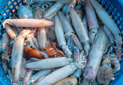
He used squid as an example.
"If you can find that profile on the bottom, you're going to find squid," Goethel said.
His ideal system would make that type of information available while fishermen are underway.
"Wouldn't it be nice to have transmitters all over the ocean of water temperature and then all the vessels are fitted out with the receivers, so as you steam to wherever the grounds are you can actually get water temperatures?" he asked.
The potential benefit is not simply catching more fish. Better information could help fishermen avoid bycatch, reduce unproductive steaming, and burn less fuel.
The speaker recalled once steaming for 17 hours to escape an area saturated with dogfish. With better information about where conditions favor certain species, fishermen could potentially make those decisions sooner.
"How can we correlate and partner and collaborate with this industry so we can target fish more efficiently?" Goethel asked. "We're not using it in that way, and I think that's where we need to continue to go and build on."
Give fishermen the data
Train offered a simple prediction about what would happen if more information became available.
Fishermen would figure out what to do with it.
"If there was more data they'd find a way to use it," she said. "You find a way to measure something else, and they're going to find a way to use it to their advantage, whether it's for safety or for more efficiency or to be able to use that current to use less fuel."
But collecting data and making it useful are two different things.
Mattera said existing information could sometimes be easily accessed, while other times users were directed to national websites and forced to drill back down to find the local observations they wanted.
That frustration came up alongside discussions about improvements to the NERACOOS Mariners Dashboard. One planned function will let users compare buoy observations against forecasts. Multiple forecasts could eventually be available for comparison.
That could be particularly useful to captains who already compare official forecasts against their own experience.
"I've heard this from many fishermen as well," Mattera said. "They're doing their own forecasting. They have their own mental models."
The fishermen are not asking a computer to make the decision for them. They want better information with which to make it themselves.
The other access problem
Eventually, a conversation about access to data became a conversation about another kind of access. Working waterfronts.
Asked about some of the biggest challenges facing those waterfronts, panelists quickly pointed to the loss of commercial access.
"Access to being able to continue keeping working waterfront, working waterfront, to continue keeping commercial ports, commercial ports is a huge issue nationwide," Aubrey Church, policy director of the Cape Cod Commercial Fishermen’s Alliance (CCCFA), mentioned in another session.
In Rhode Island, Mattera described small marinas being purchased by larger companies and converted toward luxury vessels and yachts, eliminating space used by commercial fishermen.
"That's becoming a grave issue here," he said.
Rhode Island also offers an example of one way commercial access has been preserved. Decades ago, the state acquired waterfront property in areas including Point Judith and restricted some of it to commercial fishing uses.
"No marinas, no hotels, no restaurants," Mattera said of the protected property in Point Judith. "It's exclusively for commercial fishing."
Other areas remain vulnerable. New Hampshire fishermen described a different problem. State ownership of piers can help protect commercial access but maintaining that infrastructure requires money.
Goethel recalled falling roughly 20 feet from a pier after an equipment failure and suffering serious injuries before the facility was repaired.
"You shouldn't have to fall off the pier, get 100 cracks in your head and get lifted to Boston to get the pier fixed," he said.
The stories brought the conversation full circle.
An observing system can tell a fisherman the waves are building offshore. Better bottom-temperature data could eventually help a captain spend less time searching for fish. Improved forecasts might save fuel, avoid unwanted catch, or keep a boat at the dock when conditions turn dangerous.
But the fishing industry also needs the dock itself.
Experience plus information
NERACOOS framed much of its work during the meeting around a straightforward sequence: listen, observe, deliver, and improve.
For commercial fishermen, the "deliver" part may be especially important.
The information already exists in many forms. Fishermen are already using it. They are taking screenshots of buoys, watching temperature breaks, comparing forecasts against observations, and adding all of it to knowledge accumulated through years on the water.
The opportunity now is to make more of that information available where fishermen can use it, including aboard the boat.
Train perhaps put the relationship between fishermen and ocean observations most simply. "Every trip starts with weighing the risk against the job that needs to get done," she said. "Ocean observations can help take some of the uncertainty out of that equation."
They cannot tell a captain whether to leave. But they can give that captain one more reason to know when not to.