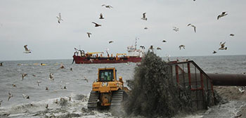
Emergency beach replenishment by the Corps of Engineers rebuilt beaches after hurricane Sandy in 2012. USACE photo.Ocean planners who are trying to balance all uses in U.S. waters – from traditional fishing grounds to marine transport, and the new arrivals in offshore wind energy – now have something even more basic to worry about.
The bottom.
To the obvious offshore geologic resources of oil and natural gas, add seafloor sand – not just any old sediment, but the nice clean, quartz-rich stuff that summer beachgoers like between their toes.
Mid-Atlantic states and the Army Corps of Engineers want to dredge more sand off the nearshore ocean floor, not just to protect pricey seaside real estate, but whole stretches of urban coast threatened by slow sea level rise and storm onslaughts like Hurricane Sandy in 2012.
They need it not just to widen beaches now, but to keep replenishing them – a 50-year timeframe for the biggest Corps projects.
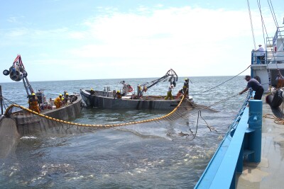
Huge federal resources have poured in since Hurricane Sandy in 2012, and related dredging and support continues to be a big market for the workboat industry. Corps officials say there are just not enough capable dredges and other equipment to meet demand.
So when the 131’x29’6”x10’ OSV Scarlett Isabella showed up off the New Jersey coast in June, fishermen who follow the Corps’ beach-building efforts took notice. The vessel made an acoustic survey of the sea floor for the federal Bureau of Ocean Energy Management, including an area fishermen call the Manasquan Ridge – undersea sand hills, relics of the last ice age, when sea levels advanced as the continental glaciers melted.
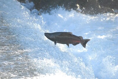
Today those shallow seafloor features attract and hold fish. The hills are also full of sand grains just the right size for pumping onto beaches. Hence the interest from BOEM and the Corps, which is looking to rebuild a nearby 14-mile stretch of beach.
Jim Lovgren, a commercial trawler captain out of Point Pleasant Beach, N.J., said he saw the summer flounder he catches disappear after the Scarlett Isabella pinged the ridge sediments.
But what really worries Lovgren is what happens if the hills are excavated to fill in beaches, and what conflicts the demand for sand will trigger as the Corps comes under more pressure to save beachfront resorts.
“There are places like this all up and down the East Coast,” Lovgren said. Commercial and recreational fishing boats, and the coastal economy, depend on those fishing grounds, he said.
The Obama administration is trying to fulfill a longstanding, bipartisan effort to rationalize ocean planning, with help from regional planning bodies. Those first plans have emerged in recent weeks.
The need for government agencies to share what they are doing was apparent at one recent public session on the Mid-Atlantic plan, when the potential for mining the Manasquan Ridge came up.
“I just learned about this three weeks ago,” said Kevin Chu, assistant Northeast regional director for the National Marine Fisheries Service, explaining he only found out when a fisherman called him.
So the regional planners – and national ocean policymakers who will be around in 2017 after this election – have one more conflict to think about.
This post first appeared on the website for our sister publication, WorkBoat. It is reprinted with permission.