The importance of radar and AIS (automatic identification system) on a vessel goes without saying. Both devices detect traffic and obstructions on the water, navigate through fog, or locate a tender to offload catch in the dark of night.
On the flip side, AIS is also handy for landlubbers wanting to locate loved ones in remote areas via satellite devices, marine tracking websites, and apps.
Although some trackers may tout “real-time” locations, they can be delayed, so the platforms should only be used for check-in and not navigation. Leave navigation up to AIS and radars.
But for those at home, the apps and sites give a window into a world we never get to see. For that, the Partners of Commercial Fishermen (POCF) private community voted on the top marine tracking platforms for fishing vessels. But to all POCFs, I say, “Read at your own risk,” and for good reason.
As some POCFs find comfort in locating their fisherman at any given moment, another camp believes the “Let go and let God” mentality is the best way to get through a long season. Otherwise, too much thinking leads to anxiety as we wonder and worry about our fishermen’s safety.
Or, as one partner put it, “I’m not sure what is better; checking the map every two seconds because that's the only update you get with them out of contact or having nothing. Both are equally frustrating.”
The other snag is that tracking doesn’t work for all vessels.
It generally depends on the size of the boat or if the captain transmits location through AIS. Some just receive instead of transmit, and currently, the US only requires boats larger than sixty-five feet to have AIS. “About 6 months ago, I downloaded one of those just for that purpose, only to find out his boat is too small to have a tracker,” one partner said, “I was bummed!”
But if everything adds up, and your partner has an iron will, it may be fun to connect through the magic of tracking websites or even a satellite device (see top satellite devices here). Now that disclaimers are out of the way, here are the Top 3 Marine Tracking Platforms most used by fishing families:
MarineTraffic
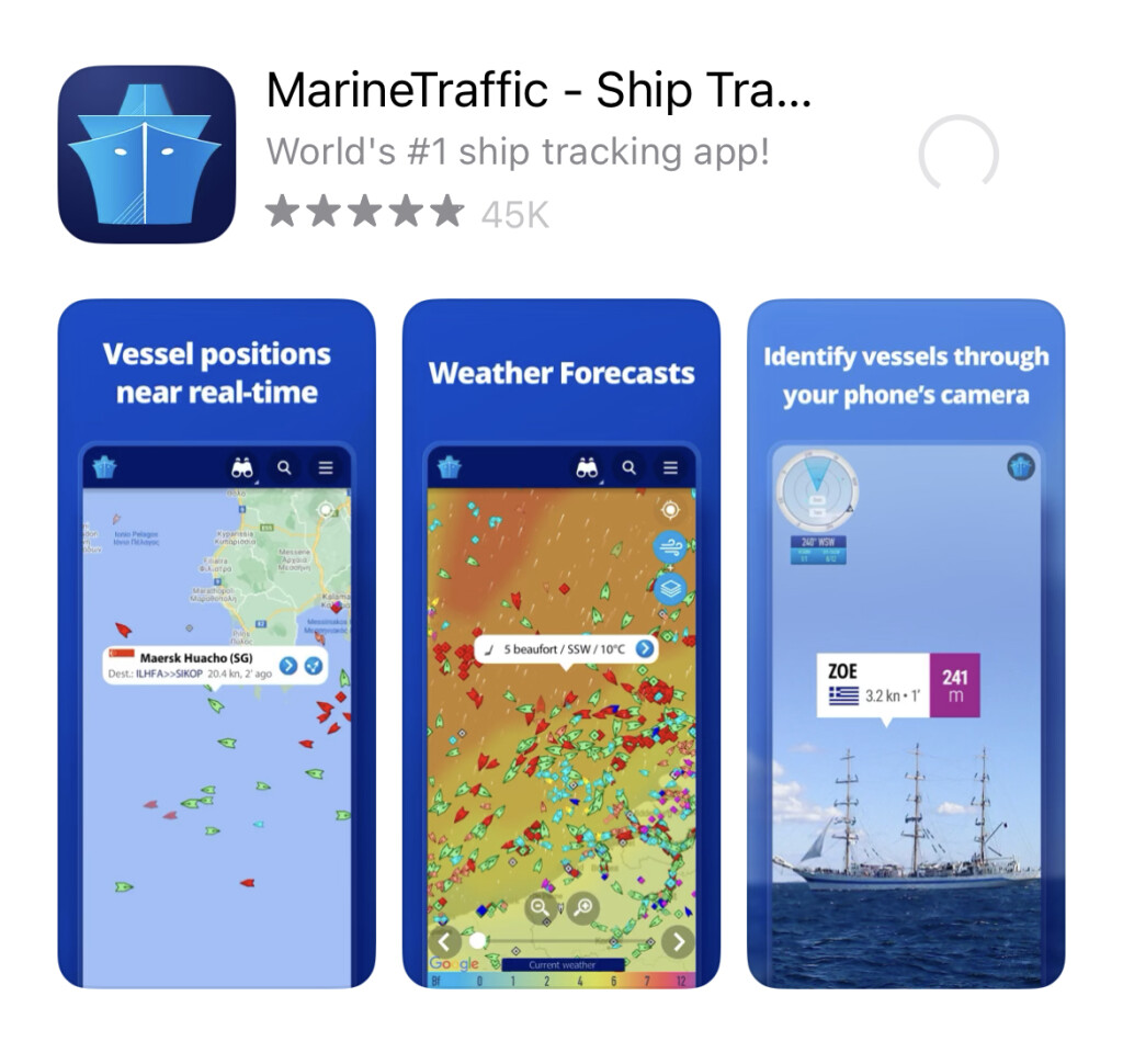
By far the most favorite on the list for both iOS (or Apple) and Android users. Once the MarineTraffic app is downloaded on a phone (or via marinetraffic.com), use the search bar to locate any port or fishing vessel that you can then “heart” to save into a “fleet” and get tracking notifications. Saving into a fleet means you can locate just the vessels you want without all the distractions of other traffic.
It’s free, with the option to upgrade for more vessel specifics. The basic “Starter Plan” is $9.99 a year. There’s also a weather map and wind forecasts for the iron-willed, but it will cost you more than your peace of mind (about $100 annually).
“My man sends me his coordinates when he calls on the satellite phone, so I can see where he is on the map,” one POCF said. “Sounds silly, but makes me feel connected to him.”
I’d show a screenshot of an identified fishing vessel, but as a fisherman’s wife, I know it’s taboo to out a lucrative spot.
Vessel finder
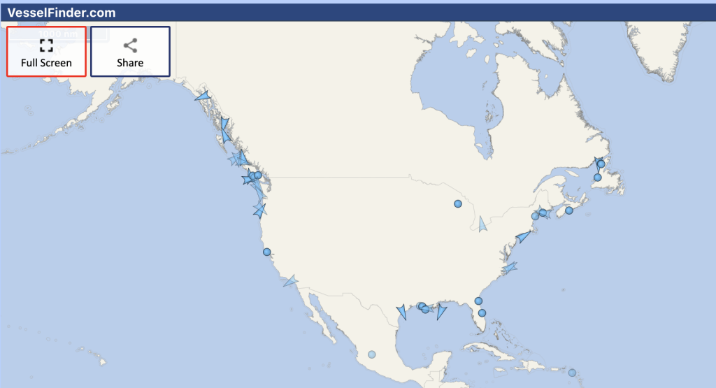
Vessel Finder takes a couple of clicks to download before you’re connected to fleets and vessels laid out in a rainbow of colors on a world map. (Fishing vessels are light blue.) That is, vessels that have AIS transponders.
You can also look up a vessel by name or port. And it’s free. Up to a point, anyway. To get vessel specifics, you’ve gotta upgrade to a “VesselFinder Pro and Subscription” to discover, in their words, “vessel particulars data, more port call results, increased number of vessels in ‘My Fleet’” which organizes data and show only the boats you want to see.
Or, you can upgrade to the Satellite Plan to get satellite positioning and ETA/route predictions, too. This baby works for both iOS and Android/Google devices.
Marine Vessel Traffic
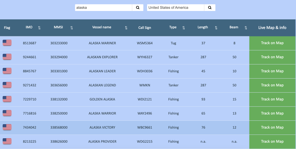
Simply typing in a vessel name to be located on a map make this one feel user-friendly. However, it doesn’t have its own tracking system. Instead uses a combination of the Marine Traffic and Vessel Finder to position a vessel on the map. In addition to location, you can learn the type of vessel, length, beam, call sign, and other fun facts like the ETA, port, destination, course, draught, and speed.
What are your favorite tracking platforms, and why? Please share in the comments below!