A one-stop tool allowing users to explore data on fish distribution and survey abundance, species life history, essential fish habitat (EFH), fish vulnerability to climate change and more has been launched by the New England and Mid-Atlantic Councils and their partners.
Dubbed the Northeast Regional Habitat Assessment Data Explorer, the website was developed as part of the Northeast Regional Marine Fish Habitat Assessment (NRHA), a collaborative, multi-disciplinary effort to describe and characterize estuarine, coastal and offshore fish habitat distribution, abundance and quality in the Northeast. A work team spent three years collecting and analyzing data and populating the Data Explorer with information for more than 65 finfish and shellfish species through 2019. New data will be added over time, the organizations report.
“While stock assessment scientists, researchers, and fishery managers will be the primary users of this comprehensive collection of information,” reports the NRHA team, “commercial and recreational fishermen will be able to call up maps showing key information about the species they catch. Other stakeholder groups interested in habitat issues, seasonal ocean conditions such as salinity, and fish survey information also should find the site helpful.”
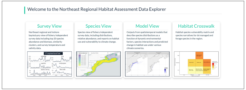
The Data Explorer comprises the following four major categories and views:
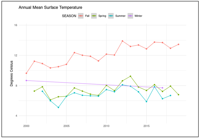
Survey view: This tab summarizes fishery independent survey data at both a Northeast regionwide scale and in inshore waters at a bay/estuary scale. Specific surveys and year ranges can be selected to display: species abundance and biomass; species that are caught together (a cluster analysis); and salinity and temperature data from selected surveys.
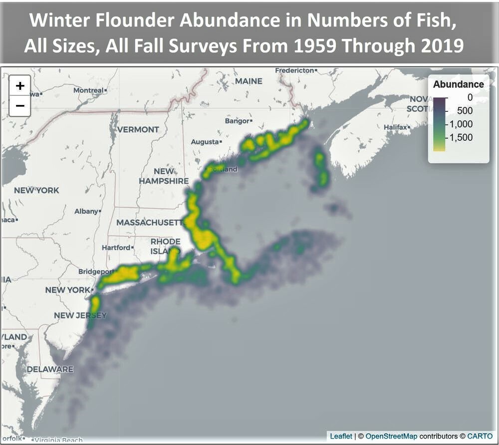
Species view: This view provides a deeper dive into species-specific fishery independent survey data. Users can click on the tabs to view a species distribution map; abundance and biomass by year; relative abundance by month and salinity zone; and species reports with life history info, vulnerability to climate change and EFH designations. Users can select a desired location, surveys and species, and then hit “Run Analysis” for results.
Model view: Although still under development, this tab will include habitat distribution model results when completed.
Habitat Crosswalk: This integrates the outputs from the Northeast Habitat Climate Vulnerability Assessment (HCVA), the Northeast Fish and Shellfish Climate Vulnerability Assessment (FSCVA) and the Atlantic Coastal Fish Habitat Partnership (ACFHP) habitat-species matrix for use in fisheries management. The major objectives were to create a habitat-species vulnerability matrix and develop species narratives for 66 managed and forage species in the region.
In addition:
- A Reports tab gives users the ability to download survey metadata.
- The NRHA Data Explorer hosts information from many Northeast Region trawl and seine surveys, making it an easy launching point for data searches.
The NRHA team reports that it will be working with the New England and Mid-Atlantic Councils to develop outreach and communications materials over the fall and winter to help users learn how to navigate the Data Explorer and make the most of its extensive repository of information.