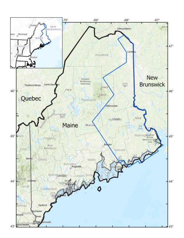
The U.S Geological Survey plans low-altitude flights in November over eastern Maine from the Downeast coast up into northern Aroostook County, using airborne geophysical technology to search for valuable minerals, the USGS announced Nov. 4.
“Partnership with state surveys helps accomplish national goals like mapping the critical minerals the U.S. needs. Researchers at the Maine Geological Survey are helping with the work of the nation – and adding to state knowledge crucial to water resources, hazards and the resource economy,” said Jamey Jones, science coordinator for the USGS Earth Mapping Resources Initiative.
Amber Whittaker, a senior geologist with the Maine Geological Survey, said the USGS survey can reveal new information about Maine’s rocks – and their potentially valuable minerals.
“This modern high-resolution geophysical survey will cross five different geologic terranes and their boundaries, giving us valuable information on Maine’s geologic history and a road map for moving forward with detailed mapping of the Downeast region. I expect to be amazed by what it reveals,” said Whittkar.
Geophysical surveys help geologists image physical properties of the rocks, including composition and structure, information that can potentially help map out future mining and extraction projects on the ground.
“Potential mineral commodities in the region include antimony, cobalt, copper, gallium, germanium, manganese, zinc, nickel, platinum group elements, tin, and tungsten, all of which are on the List of Critical Minerals maintained by the USGS as essential for the U.S. economy and national security,” according to the USGS. “One industrial use of cobalt is for manufacturing lithium-ion batteries used in computers, power tools and vehicles. There is also additional potential for iron and gold in the survey area.”
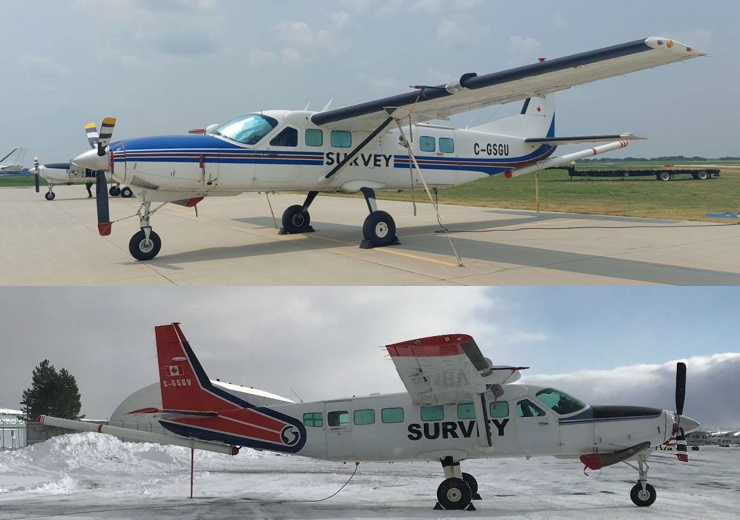
The Geological Survey has contracted with Dewberry and Sander Geophysics Ltd to collect the airborne data. The company uses Cessna 208 Grand Caravan fixed-wing aircraft, equipped with distinctive elongated “stinger” tail housings that carry sensors collecting data behind the main cabin.
“These scientific instruments are completely passive with no emissions that pose a risk to humans, animals, or plant life. No photography or video data will be collected. The aircraft will be flown by experienced pilots who are specially trained and approved for low-level flying,” the USGS offers as assurance to Mainers on the ground.