The U.S. Army Corps of Engineers is making an emergency survey of the Manasquan Inlet next week to assess a large and potentially dangerous sandbar that has developed in the inlet, which is located at Mile Zero of the New Jersey Intracoastal Waterway (NJICW), about six miles south of Shark River and 13 miles to the northeast of Toms River, N.J.
The Corps visit is a result of Rep. Chris Smith (R-NJ) meeting with various leaders in the New Jersey fishing industry while surveying the inlet this past week.
“The Corps’ new survey … will help them better evaluate the most recent developments and any action that must be taken for the safety of commercial and recreational boaters on the inlet,” said Smith in a statement. “We appreciate their response.”
The Manasquan Inlet is considered a “dynamic” inlet – one in which the sand is constantly changing. The Inlet closed on its own for several years in the 1920s, and was only restored after the Army Corps built the jetties, which remain today.
“Shifting sands in the Inlet are not new, but this oversized low-tide sandbar in the inlet has not been seen in our lives,” Smith continued. “We are gravely concerned that it will pose a serious hazard to navigation. Out of concern for the local fishing and boating community, I reached out to Lieutenant Colonel Ramon Brigantti of the Philadelphia District of the Army Corps of Engineers and strongly urged him to return to Monmouth and Ocean counties to rectify this situation.”
In addition to evaluating the sand bar that is visible at low tide, Smith also urged Brigantti to have his team study the channel depth throughout the inlet. He noted that if the matter continues to escalate, larger vessels – including the commercial fishing fleet – may experience groundings.
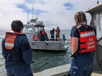
Manasquan Inlet is home port for the Fishermen's Dock Cooperative's trawlers and gillnet vessels, scallopers and surf clammers, and a large for-hire charter and party boat fleet.
During a phone conference with the Army Corps as well as Captain Howard Bogan of the fishing vessel Jamaica from the docks of Bogan’s Basin in Brielle, New Jersey, Smith emphasized the following key points:
- Reports that there was at least one spot in the federal channel that was only nine feet deep. “As you know, some of the vessels in the local commercial fleet require up to 12 feet of depth, leaving them at risk of grounding. Should that happen, it would be both very dangerous and extremely costly,” Smith noted.
- The fear that under stormy conditions, the sand bar will be very dangerous to all vessels. “Under fair weather conditions, boats can steer clear of the sand bar, but with a 25-knot wind pushing them around, it will be very dangerous – especially if the sandbar continues to grow at the current rate,” said Smith.
- “Understanding that the safety and viability of recreational, for-hire and commercial vessels is of utmost importance at all times of the year, and especially during these last few weeks of summer when inlet traffic is at its peak.”
Smith also spoke with Point Pleasant Beach Mayor Paul Kanitra and Councilman Michael Ramos, who discussed their concerns about the situation’s effects on the local fishing community, as well as the challenges of keeping people off the sand bar that has resulted from the shoaling. In addition, Smith met with charter boat Capt. David Goldman of Shore Catch Guide Service, who explained how the shifting sands have changed the wave action at the mouth of the inlet making it more challenging for smaller boats to traverse the waterway during this busy time of year.
“The Army Corps of Engineers is the federal government’s master builders, and nobody does it better than the Corps,” Smith added. “We appreciate their response and new survey of the inlet.”