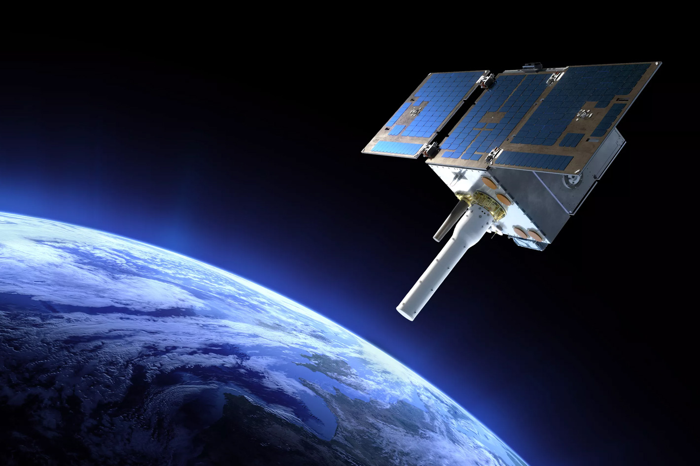
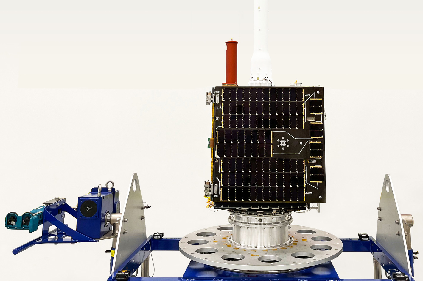
Launched into orbit October 7, NOAA's ARGOS-4 is an advanced satellite instrument that will track the movement of wildlife, particularly marine mammals and sea turtles and help the future of fisheries.
Developed in a partnership between NOAA and CNES, the French Space Agency, Argos-4 was successfully launched into orbit Oct. 7, to collaborate with its sister Argos instruments to help improve and extend data collection around the world. The Argos worldwide Data Collection System (DCS) is a network of instruments onboard polar-orbiting satellites that collect sensor and location data from both stationary and mobile transmitters around the world.
The Argos System was created in 1978 by the French Space Agency, the National Aeronautics and Space Administration and the National Oceanic and Atmospheric Administration. The name Argos comes from the Greek mythology and refers to a giant with one hundred eyes known as “the all-seeing-one.” The modern Argos watches the blue planet from roughly 530 miles above Earth with its digital eyes. NOAA has now added another eye to the giant.
In 1986, CNES created a subsidiary, CLS (Collecte Localisation satellite), to operate, maintain and commercialize the system. Today, CLS is the exclusive provider of Argos satellite telemetry services for scientific and environmental applications. CLS has been providing satellite-based solutions for location and environmental data collection for nearly 30 years.
Initially founded by CNES (the French Space Agency) and IFREMER (the French Research Institute for Exploitation of the Sea) to operate and market the ARGOS system, CLS today provides satellite-based solutions to 5 sectors of activity, including environmental monitoring, maritime surveillance, energy & mining, sustainable fisheries and fleet management.
Currently, several international space agencies besides NASA and CNES also actively participate in the Argos system including the European Organization of the Exploitation of Meteorological Satellites (EUMETSAT), the Indian Space Research Organization (ISRO) and others.
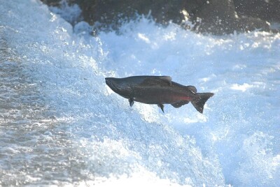
Argos has most famously been used to track wildlife, particularly marine mammals and sea turtles since the 1980s, which has allowed researchers to learn more about them, but the information gathered via the Argos system also assists with maritime security, offshore pollution, and humanitarian efforts while enabling industries to comply with environmental protection regulations.
 Help preserving the rich resources of the marine world
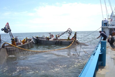
Enforcing quotas and fishing zones to preserve stocks for future generations is one of the key features of Argos, as the future of fisheries around the world depend to a large extent on our ability to preserve stocks effectively. Argos has been certified by most of the leading seaboard nations around the world and is already operating on thousands of vessels worldwide.
Establishing, managing and monitoring marine protected areas is a key element to preserve the rich resources of the marine world, and governments are developing programs for Marine Protected Areas (MPAs). In that sense, the satellite location and data collection solutions developed with Argos system provide support to MPA managers. The system can be used to observe the behaviour of marine species thus aiding authorities to establish critical zones and periods for safeguarding biodiversity.
Here are some more features the Argos system offers:
Tracking fishing boats, communicating and managing fisheries
- To support the implementation of sustainable marine-resource management policies, CLS has developed the Vessel Monitoring System (VMS), a satellite-based system for monitoring and managing fisheries.
- CLS provides an equipment package (transmitter + software) that meets the specific needs of the industrial and small-scale fishing sectors.
Combating illegal, undeclared, unregulated fishing (IUU)
- The VMS system identifies ships equipped with a satellite location transmitter. It improves real-time observation of ship positions and activities, boat by boat, fishery by fishery, in order to provide a better estimate of on-board stocks.
- It also makes it possible to detect unregistered vessels in the zone.
Supporting the development of small-scale fishing
- To meet the management and support needs of small-scale fishing boats, CLS provides a tracking system that identifies boats equipped with satellite location transmitters.
- This system makes it possible to manage potential conflicts between industrial and small-scale fishing activities more effectively. It can also be used to assist operations in the event of problems arising.