NOAA Fisheries is preparing to launch its annual eastern Bering Sea bottom trawl survey, with scientists set to begin collecting near real-time temperature data in June as part of one of the longest-running fishery datasets in the region.
Conducted each year by the Alaska Fisheries Science Center, the survey is mandated under the Magnuson-Stevens Act to track the distribution and abundance of fish, crab and other bottom-dwelling species. The data is used to inform stock assessments and ecosystem status reports for the North Pacific Fishery Management Council.
Water temperature remains a key focus of the survey. According to NOAA, “temperature is one of many factors that influences species’ ranges and population sizes,” with warming conditions already linked to shifts in where species are found. Scientists record both bottom and surface temperatures at each station, allowing them to compare environmental conditions with the presence, or absence, of fish and crab.
The 2026 survey will include regular updates, with NOAA noting it will “update this page with the most recent bottom temperatures recorded on most weekdays during the survey.” Unlike 2025, which included both eastern and northern areas, this year’s work will focus solely on the eastern Bering Sea.
Survey data also play a central role in tracking the Bering Sea “cold pool,” defined as bottom water at or below 2 degrees Celsius. Formed each spring as melting sea ice creates dense, cold water that sinks to the seafloor, the cold pool acts as a shifting boundary that can separate Arctic and subarctic species.
“Commercially important fish like walleye pollock, Pacific cod, and snow crab are dependent on the location of the cold pool,” NOAA states, underscoring its importance to both ecosystem dynamics and the commercial fishing industry. As ocean temperatures warm, scientists continue to closely monitor changes in the cold pool’s size and location.
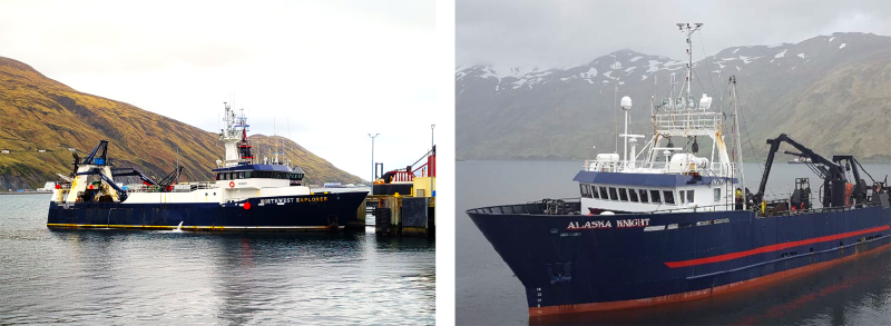
The survey will run from early June through the end of July aboard the F/V Northwest Explorer and the F/V Alaska Knight, departing Dutch Harbor on May 31. Following the survey, both vessels will remain at sea for gear modernization trials through mid-August.
NOAA notes that the eastern Bering Sea survey has been conducted annually since 1982, with the exception of 2020, making it “the longest running, standardized time series of fish and invertebrate data in the region.”
All data collected during the survey will be made publicly available through NOAA-supported data portals, with preliminary results expected to be presented later this fall.