A draft environmental impact statement on Ørsted’s Ocean Wind 1 project shows how potential effects on fishing could figure into the federal Bureau of Ocean Energy Management’s planning for the first commercial wind development off New Jersey.
So too are visual effects of building a 1,100-megawatt turbine array 13 miles off Atlantic City, N.J., and other southern Jersey Shore beach resorts. The Ocean Wind 1 project – and the Atlantic Shores project planned on a nearby federal lease to the north – have drawn fierce resistance in seaside communities.
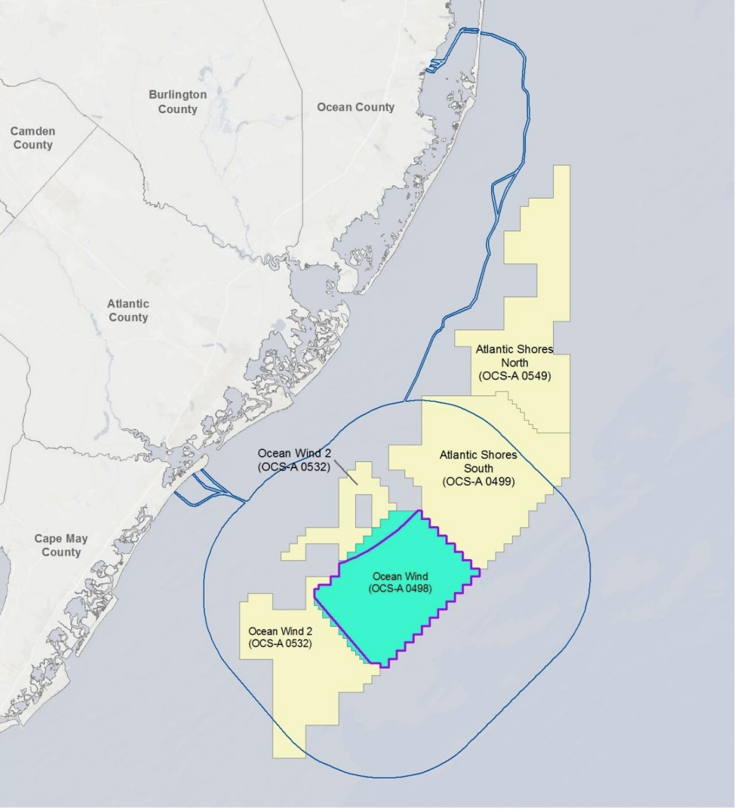
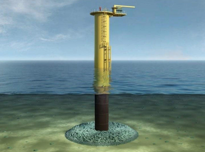
Up to 98 wind turbines and three offshore sub-stations would generate power and send energy by export cables to two obsolete power plant sites on shore: the BL England site, a former coal-fired plant, and Oyster Creek, the nation’s first commercial nuclear power station, now decommissioned.
The sweeping draft environmental impact statement of 1,408 pages discusses BOEM’s preferred plan, and its potential effects on both wealthy coastal and low-income communities; marine mammals and other wildlife; fishing and maritime industries; tourism and recreation. It offers alternatives to address objections and suggestions that the agency heard during its scoping process.
Some of those options include excluding potential wind turbine sites to reduce the visual effect of seeing the 900-foot tall machines from the beach.
Other changes could shift turbine locations away from undersea sand ridges and troughs – significant seafloor features that attract fish and are prime grounds for the region’s party and charter boat fishing fleet.
The public review and 45-day comment period for the draft document formally opens Friday, June 24. BOEM will schedule three virtual online public meetings:
- July 14 at 1 p.m. Eastern time
- July 20 at 5 p.m.
- July 26 at 5 p.m.
Details about the hearings and instructions on registering will be published on the BOEM website.
The turbine array would be built in a grid pattern, with turbine towers spaced at 1 nautical mile by 0.8 nautical mile locations, in a southeast-to-northwest orientation.
One alternative considers calls for a buffer area between Ocean Wind and Atlantic Shores between 0.8 and 1.08 nautical miles wind.
“A buffer would provide a clear visual distinction between the separate projects and provide for sufficient maneuvering space” for surface vessels and helicopters, aircraft that will be used for servicing turbines, according to the document.
But one concession sought by the commercial surf clam fleet – a 2-nautical mile spacing between turbine towers – was turned down by the BOEM analysis. Reducing the number of turbine locations so much would make the project unfeasible, the draft document says.
The 2-mile spacing would cut down the turbine layout plan by two-thirds and fall far short of New Jersey’s 2019 solicitation award of 1,100 MW for the project, according to the analysis.
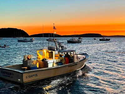
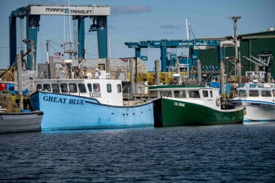
Scallop and surf clam dredge fisheries account for most of the commercial landings from the Ocean Wind 1 lease area, according to National Marine Fisheries Service data cited in the draft EIS.
The document acknowledges that the surf clam fishery is the one most likely to be affected by Ocean Wind 1. Ocean Wind 1 lies off Absecon Inlet, where Gardner’s Basin and Clam Creek at the north end of Atlantic City are a historic home port for the clam fleet.
“While Ocean Wind’s NSRA (navigation safety risk assessment) shows that it is technically feasible to navigate and maneuver fishing vessels and mobile gear through the Wind Farm Area, BOEM is cognizant that maneuverability within the Wind Farm Area may vary depending on many factors, including vessel size, fishing gear or method used, and environmental conditions such as wind, sea state, current, and visibility,” agency analysts wrote.
“In addition, BOEM recognizes that even when it is feasible to fish within the Wind Farm Area, some fishermen might still not consider it safe to do so. Furthermore, operating within the Wind Farm Area with other vessels and gear types present may restrict vessel maneuverability.”
The fishing industry also requested a minimum burial depth for cables of 8 to 10 feet to avoid interactions with fishing gear – or if shallower depth is permitted, using or, remote monitoring to make sure the cables stay deep enough in the sea floor. The plan calls for a total 384 miles of submarine cables.
The Ocean Wind developers propose target burial depths of 4 to 6 feet, with final depths to be coordinated with regulatory agencies. Burial depths and remote monitoring can be addressed among mitigation measures in the final environmental impact statement without adding it as an alternative measure in the draft document, according to BOEM.
One alternative under consideration is altering Ocean Wind’s northward export cable route to the Oyster Creek site. Under the plan the cable would make landfall on Island Beach State Park north of Barnegat Inlet, be buried across the barrier island, and then under Barnegat Bay to the old nuclear plant.
The exact route could be altered to minimize disturbance to the shallow bay’s submerged aquatic vegetation, like eelgrass that is critical habitat for juvenile fish and blue crabs. Barnegat Bay is plagued with nutrient overload from storm water runoff and resulting water quality problems that have reduced the underwater meadows.
The draft document includes some details about how the construction and operations phases of Ocean Wind 1 would proceed.
Atlantic City will serve as the construction management base. Ørsted will rehabilitate an old marina area with 500 feet of waterfront off Absecon Inlet at the city’s north end, and use the location as the continuing operations and maintenance facility.
Foundation fabrication and delivery may come from Paulsboro, N.J., on the Delaware River or directly from Europe.
Wind turbines would be pre-assembled on shore and sent out for installation from Norfolk, Va., or the newly developing New Jersey Wind Port at Hope Creek on upper Delaware Bay. Both ports are in contention to be major hubs for offshore wind projects in the Mid-Atlantic.
The construction phase will be busy off New Jersey beaches. During installation for cables linking turbines and the three substations, up to 20 workboats may be operating during a typical work day, according to the draft document.
As the export cables are laid to BL England and Oyster Creek, up to 26 vessels could be at work on the task.
After an anticipated 35-year service life, all Ocean Wind structures and cables would be required to be decommissioned and removed, with the seafloor cleared to a depth of 15 feet, according to the draft statement.