With category 3 winds already of 120 mph, hurricane Ian is forecast to make landfall on the Florida Gulf coast between Fort Myers and Sarasota, likely building to category 4 and bringing storm surges of 5 to 10 feet along the heavily developed coast.
Authorities from Naples north to Tampa ordered mandatory evacuations of highly vulnerable neighborhoods, including those miles from the beaches where surges will roll up coastal rivers and residential canals. Lee, Charlotte, DeSoto, and Sarasota counties are under a hurricane warning.
The strength and final path of Ian remains uncertain, but “whether Ian comes ashore as category 4 hurricane or a large category 3 after an eyewall cycle, avoiding a large and destructive hurricane for Florida seems very unlikely, and residents should heed the advice of local emergency management officials,” the National Hurricane Center warned in its 5 p.m. Tuesday update.
Hurricane-force winds are expected in the hurricane warning area in southwest and west-central Florida beginning Wednesday morning. Those will build into tropical storm conditions expected overnight, and “devastating wind damage is expected near the core of Ian,” according to the center.
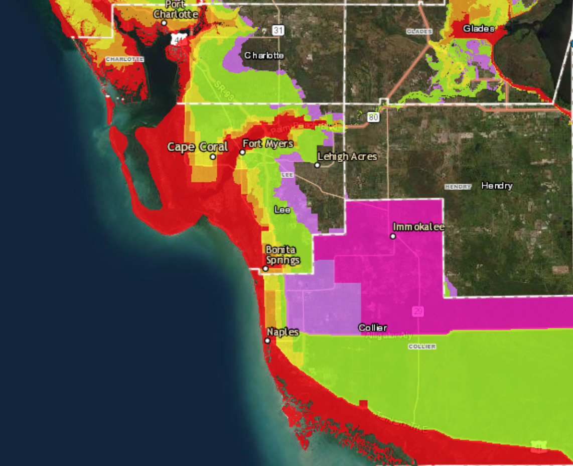
Peak surges could reach 8 to 12 feet from the middle of Longboat Key to Bonita Beach, including Charlotte Harbor, and 8 to12 feet from Bonita Beach to Chokoloskee, the hurricane center said. To the north Tampa Bay, which had been in the bullseye of earlier predictive modeling, is still looking at surges of 4 to 6 feet.