In January 2025, Garmin Marine acquired SeaStar software and integrated it into its service ecosystem with the aim of optimizing efficiency in commercial fisheries.
Maxar launched the earliest version of SeaStar in 1997, offering commercial fishermen data on chlorophyll concentrations, primary production, bathymetry, marine weather, and more.
“Garmin’s SeaStar Fisheries Information service includes a PC-based software application called InsightExplorer that is used to review data layers, incorporate catch data, and interact with our proprietary filtering tool, Master Cast, which allows users to manipulate and sort data to predict higher probability activity,” says Garmin spokesperson Carly Hysell.
Hysell notes that the software requires an internet connection in order to function. Hardware requirements include a PC running Windows 10 or higher. “Our recommended system requirements for computers are: CPU 2 GHz, Memory 8GB, Video Card: 2GB RAM, DirectX 9+, a 21-inch monitor, 4 USB Ports, and a 64-bit machine,” she says. The Garmin website adds that users will also need a compatible Garmin Marine Network chartplotter, such as the GPSMAP series.
According to Hysell, the data used for Garmin’s SeaStar Fisheries Information Service comes from an evolving mix of public and private sources published by scientific, academic, and government organizations worldwide. “Some are well-known entities such as NOAA and NASA as well as a portfolio of proprietary sources allowing weather, oceanography, vessel AIS history, and catch data,” she says. “Garmin’s internal team of oceanographers synthesizes and refines this data to be published daily.”
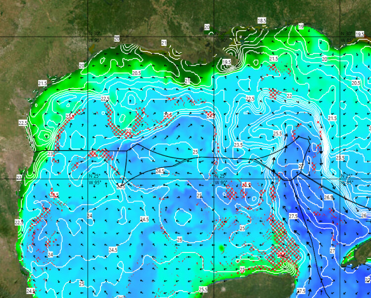
Hysell points out that since its inception, the service has grown to include an increasing array of layers with higher resolution and accuracy. In addition to the layers noted above, the list includes sea surface and subsurface temperatures, sea surface height anomalies, thermocline depth, Vessel AIS, ocean salinity, primary production, and more. According to Garmin, the service helps minimize fuel costs and maximize catch rates by identifying waters with a higher probability of productivity. Additionally, SeaStar allows for monitoring red tides in real-time through detection algorithms applied to its layers of oceanographic data.
“Using Master Cast, captains can combine intuition with daily charts of ocean conditions to help locate the closest, most productive fishing grounds for desired species,” says Hysell.
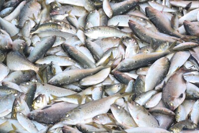
Garmin’s SeaStar Fisheries Information Service is advertised as being available worldwide. “It has been deployed by hundreds of vessels representing more than 30 countries,” says Hysell. “It is being used in fisheries such as squid jigging, longline, purse seine, trawl, and rod and reel.” She adds that target species include small pelagics such as anchovies, sardines, herring, mackerel; larger pelagics like tunas, mahi, and swordfish, and groundfish.
“Monthly subscription pricing varies by application, fleet, and services contracted,” Hysell says. “Installation, service, and support are included.”